Wildfire
Wildfire standard notice
- Box Color
- bg-quartz
- Header
- Area notices
- Description
-
Please note that this site is currently closed. Please check back regularly for updates.
Wildfire standard notice
Please note that this site is currently closed. Please check back regularly for updates.
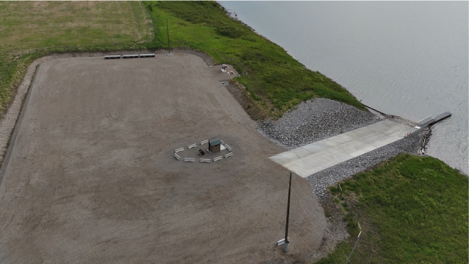
Located between Fort St. John and Hudson's Hope, our Halfway River (Táájiidze Saahgí) boat launch provides boaters and anglers with access to the Nááchę Mege (formerly Site C reservoir). The boat launch is open seasonally from May to October. This site also includes picnic tables and a pit toilet for public use.
The Halfway River boat launch is located approximately 50 km from Fort St. John along Highway 29. Use this Google Map link for directions.
The Halfway River boat launch is owned and maintained by BC Hydro.
Facilities include:
The Nááchę Mege Reservoir map [PDF, 24 MB] has been prepared to support safe recreational vessel use on the reservoir. While reasonable efforts have been made to depict bathymetry, navigation hazards, and other features relevant to vessel operators, the reservoir is a managed and dynamic environment. Water levels, shoreline conditions, debris, and hazards may change due to operational, environmental, or weather-related factors. This map is not an official nautical chart and is not a substitute for prudent seamanship, on-site observation, official notices, or compliance with local regulations, posted signage, and navigation aids.
Users remain responsible for assessing conditions and navigating safely at all times.
All persons intending to operate a boat on the reservoir should always:
The banks of the reservoir are easily eroded and subject to sloughing from reservoir actions. If waves are severe and you need to reach shore, it may be difficult to make a safe landing due to cliffs, unstable banks and floating or submerged debris along the shoreline.